This week we were issued a new brief that dealt with heath implications in the Denver settlement. We had to investigate the primary health services that are offered.
We began by interviewing some community members on the health care system and whether it works or not and how we could improve it.
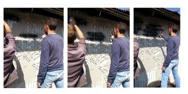
SHACKS INTERVIEWD
HOUSES THAT WE INTERVIEWED AND THEY RELATIONSHIP TO SITE ELEMENTS.
After our site visit we began by building an accurate working model of sector F. This model was built to help us understand the spatial and environmental nature of our site.
BUILDING SITE CONTOURS
CUTTING OUT THE SHACKS
PLACING SHACKS
FINAL MODEL IN PROCESS
Our construction brief required us to conduct a comprehensive analysis of the public need of the Denver informal settlement, design a response and detail the response.
This week we outlined the main problems and came up with conceptual solutions.
MAIN PROBLEMS THAT WE FOUND ON SITE
THE BENEFITS OF FIXING THESE MAIN PROBLEM POINTS AND HOW THEY SPILL INTO OTHER PROBLEMS ON SITE.
SOME OF THE FOCAL PROBLEMS AND POSSIBLE SOLUTIONS
Sewerage and storm water is a big problem on our site and creates a lot of problems with regards to health and smells on site.
Problem: Sewerage and storm water run off causing mud all over site and creating puddles that could have potential health implications.
Solution: Using the trees beds to create water beds capture run off water.
PLAN OF FOCAL AREA FOR CONSTRUCTION.
LONGITUDINAL SECTION THROUGH SITE.
DETAILED DRAWINGS OF SOLUTION.
ZOOMED IN SECTION OF PROPOSED SOLUTION.
The second observation was the fact that none of the shacks had windows and after interviewing some community members we discovered that the driving reason behind it was due to the crime rate and violence in Denver .
Problem: no lighting and ventilation within the shack.
Solution: creating small holes within the structure big enough to allow for light and air to flow through but not big enough to allow for fire arms or a persons hand to get through.
EXISTING HEATING AND COOLING THROUGH A PART SECTION.
CHOOSEN SITE HIGHLIGHTING WATER CHANNEL.
EXISTING HEATING AND COOLING WITHIN A SHACK.
EXISTING LIGHTING IN A SHACK( ONLY LIGHT WHEN ONE OPENS THE ENTRANCE DOOR).
INTRODUCING LARGE BINS AND MAKING THE WATER BANK A SOCIAL AREA
USING PAVING AS A FORM OF THRESHOLD TO SEPERATE THE VEHICULAR MOVEMENT AND THE PEDESTRIAN MOVEMENTS.
The third observation was the fact that people who didn't live in Denver could never find them selves in the space due to the maze like layout. This brought about the question how does the police ,fire department or ambulance get through this space to help someone in need.
Problem: place finding.
Solution: giving each sub region within our site a color, a color that spoke about the space. Implementing the color by adding concrete matts at the entrance of each shack and painting it in the regions chosen color. the concrete matt would keep water out the house, add color to the place and introduce the idea of ownership into the space.
IN THIS IMAGE WE BEGAN IDENTIFYING THE PERSONALITY OF THE SITE AND THE SUB REAGIONS AND BEGAN GIVING IN A COLOR CODE THAT METCHED ITS CHARACTERISTICS.
EACH SUB REAGION WAS GIVEN A COLOR.
WE THEN BEGAN ADDING THE CONCRETE MATTS BY EACH SHACK TO C WAT THE FINAL PRODUCT WOUD LOOK LIKE.
A SIMPLE PERSPECTIVE SHOWING WHAT THE SPACE BEGINS TO LOOK LIKE.


.jpg)